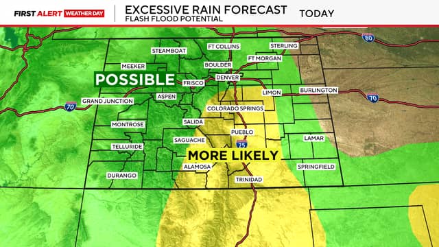
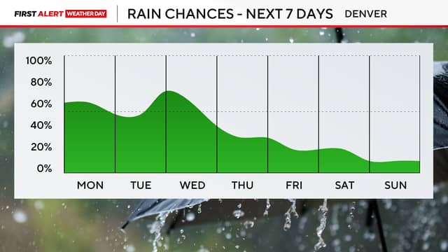
This week Colorado is enjoying a break from the heat with a cooler and wetter weather pattern. A First Alert Weather Day has been issued due to the increased risk for localized flooding.
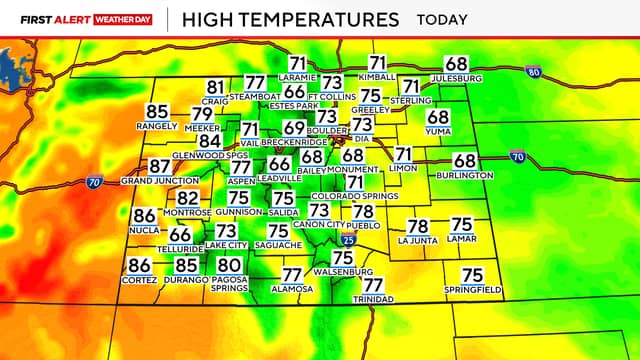
An active weather pattern is expected across much of the state this week, bringing daily chances for rain and thunderstorms, especially along the I-25 corridor and in the high country. Temperatures are also expected to remain below normal. In the Denver metro area daytime highs will be in the low 70s on Monday.
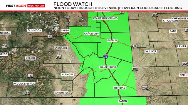
The highest potential for widespread showers and storms arrives Monday afternoon. Storms are expected to develop over the mountains and foothills before pushing east toward the Front Range and the plains. Some areas could see brief but heavy downpours. That increases the risk of flash flooding, especially in and around burn scars from recent wildfires. A Flood Watch has been issued from noon through Monday evening.
Thanks to the thick cloud cover and cool, moist air, daytime highs will remain cooler than average throughout the week.
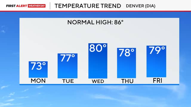
While moisture is expected to gradually decrease later this week, scattered storms are still possible each afternoon through Friday. The upcoming weekend may bring a shift toward drier conditions, though isolated storms remain in the forecast, along with a slight warming trend.
Source:cbsnews.com